Showing posts with label Tonto National Forest. Show all posts

Monday, October 14, 2013

Garden Valley Loop/Hackberry Springs

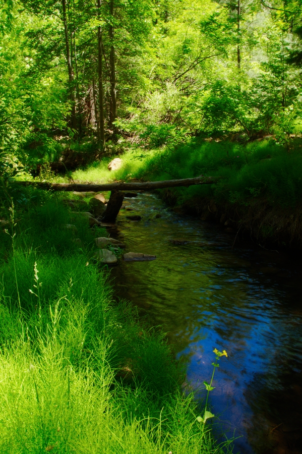
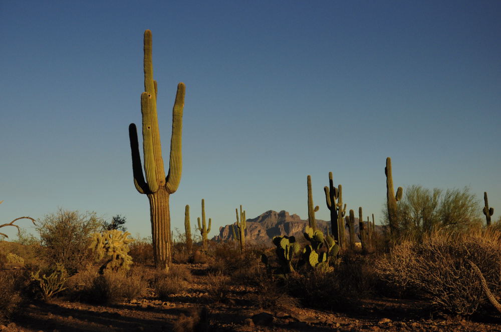
This is a great moderate loop hike along the northern side of the Superstition Mountains.  There are a few hills on this hike, but if you follow the route in the direction described, you will travel down the larger hills, rather than up. The trail is located off of First Water Road, which is a dirt road just past the entrance into Lost Dutchman State Park.  Detailed directions to the trailhead are posted at the end.  On Forest Road 78 turn right and travel approximately two miles until you see a large parking area with a restroom on your left.  Park at this spot.  There is no fee required.  Walk up the dirt road, heading east about 1/4 of a mile.  You will soon see a rough road heading off to your left and a gate.  This is the start of the trail.  Follow the road up the ridge and soon you will descend down a rocky hill.  Below you can see an old ranch, with a few buildings remaining and an old windmill.  When you reach this follow the path past the windmill towards the large rock outcropping straight ahead and to the left of you.  The trail will descend down into the creek bed.  You will shortly come across Hackberry Springs.  I hiked this in October and there was water trickling up out of the spring.  The trail soon enters a narrow canyon section.  This spot is a fun little spot.  Continue to follow the canyon down.  We saw a lot of small toads in the area and also a large tarantuala.
The trail will soon come out of the narrow section and turn to your right.  Continue to follow as the trail skirts along the creek bed.  At about mile 2 the trail will turn to your right and head up the hill. 
You will gradually climb up until you are on top of Hackberry Mesa.  Once on top continue to the follow the trail as it turns south.  You will soon come to a large open area known as Garden Valley.  Follow across the valley to a signed junction with the Black Mesa Trail #241.  Turn right at the junction and head west.  You will drop off another hill down into a ravine, with another short climb to follow.  You are about 1.5 miles from your car at this point.  Continue as you cross over another stream bed.  You will see a small trail head off to your right this will take you back to the old ranch area.  Keep on the main trail heading west and you will climb up another short hill.  At the top of the hill is the parking area for the Second Water Trail Head.  Follow the road about 1/2 mile to where you parked your car.  The loop described is 5.3 miles.  This is a great moderate hike.  It has a few hills but nothing strenuous.  The best part of the hike is short canyon section at the beginning.


Click below  for a map of the described route:

Garden Valley Loop/Hackberry Spring


EveryTrail - Find the best Hiking near Mesa, Arizona

Length: 5.3 miles
Elevation Gain:  unknown, small hills
Difficulty:  Easy to Moderate
Season:  Fall through Spring
Time:  2 hours
Fee:  No fee
Kids: Kid friendly
Directions: From Apache Junction trail NorthEast on SR88 (The Apache Trail) for 5.3 miles.  Just past Lost Dutchmen State Park you will turn right on FR78 (dirt road and passenger vehicle friendly). Travel 2 miles to the large parking area on your left.  If you travel past this you will soon come to a dead end and the Second Water Parking Area.  (This is the spot where you will come up out of your hike). 

Wednesday, July 4, 2012

Horton Creek

This is a great hike east of Payson just below the Mogollon Rim.  The trail is easy to follow, fairly flat except for a gradual hill towards the turn around point of the hike and follows a beautiful creek known as Horton Creek.  The trail is out and back, with the trail leading to the head of Horton Creek where the spring literally comes right out of the side of the mountain.  The spring is 3.3 miles from the trailhead.  This is a great hike to do on a hot summer day as the trail stays within 200 yards of the creek the entire trail, except the hill at the end of the hike.  There are large trees providing shade the majority of the hike. 

The trail is located 15 miles east of Payson on Hwy 260.  Turn left on Tonto Creek Road (FR 289) and drive 1 mile to the upper Tonto Campground.  Do not stop at the first campground on your left.  Keep driving to the second campground on your right.  Pass the entrance to the campground, cross a cement bridge and park on your left in the signed parking area.  The trail begins back across the bridge and up the road toward the campground.  You will see signs directing you to the trail.

The trail starts by dropping you down into a dry creek bed.  Follow the trail for half a mile next to the the dry creek bed.  Don't worry you will come to the water soon.  The trail will follow next to the creek for the most part.  A few spur trails will branch of to your right heading down to the creek.  These are worth taking as several spots on the creek are incredibly beautiful.  Beautiful lush green trees, yellow flowers and small water falls make this area a little paradise. 

The trail continues up towards the rim with the last mile consisting of a gradual hill switch backing its way up the base of the rim.  This is not a difficult hill and can be managed by most people, including young children.  At  the top of the hill the trail intersects with the Highline Trail.  Turn right and follow the trail for about 200 yards to the Spring.  This is a great spot and several people had backpacked and were camping in the area.  Once you reach the Spring this is your turnaround point and it's an easy hike back down the trail to your car.

I would recommend this hike to any hiking level.  Small children will enjoy playing in the water, as will adults such as myself.  The trail was fairly busy the day I hiked it on a Saturday.  But not overly crowded.  Definitely put this on your list of hikes to do in Rim Country.

Length:  6. 6 miles out and back
Elevation Gain: 1,183 feet
Difficulty: Easy- Recommended for families with small children
Season: Spring, Summer, Fall
Hiking Time: 3-4 hours with a lot of time used to enjoy the creek and the spring at the end of the trail.
Directions:  See narrative- passenger car


Wednesday, January 4, 2012

Picketpost Mountain, Superior Arizona

The trail pretty much follows the shadowline
Picketpost has been on my list for a couple years now.  I finally made it out and hiked to the top of this fortress shaped mountain in Superior, Arizona.  I would not recommend this trail for the casual hiker,  as it gains 1,990 feet in elevation in 2 miles with exposed ledges and some scrambling.   The trail starts out simple enough and then heads up through a chute leading to the flat top of Picketpost.  This trail has a steep ascent and exposed ledges in some locations. That being said, this was a great hike that I enjoyed immensely.  The biggest challenge for me was avoiding all of the cactus as the trail is not very maintained.

In the photo to the left the trail pretty much follows the shadow line to the top of the mountain. 

Most of the trail is this slippery gravel surface
To locate the trail drive east on the US 60 from Apache Junction towards Superior,.   At approximately mile post 221 look for the sign directing you to the PicketPost Trail on your right (south).  Take this road and follow it past an old windmill.  The road will T shortly,  turn left follow to the end to the trailhead.  The drive is only a few minutes from the highway.  Upon exiting I followed the old jeep trail through the gate for about .5 miles.  The road stays to the right of the dry stream bed for about .5 miles.  Look for a cairn that marks the trail leading across the dry stream bed towards Picketpost Mountain to the left.  Follow this trail directly towards the mountain.  The trail then begins to gradually climb at this point in the lower foothills of picketpost.  Pay attention to the rocks in this area, there are beautiful quartz shards scattered all over the area.  Follow the trail up the side of the hill, which was burned out from a fire a while back.  The trail then crosses over a small ravine and you are on the side of Picketpost Mountain.  From here the trail heads pretty much straight up the side of the mountain with a few switchbacks.

The Chute
As you head up the trail you will have a few sections requiring you to scramble up and over rocks, the trail will lead to your right toward the long chute.  This is the route up the mountain.  As you near the chute be careful of your footing.  The hardest section is here as you have to scramble over several rocks and a few are exposed ledges.  Follow the cairned trail and faded paint arrows up the chute.  Several trails branch off but my recommendation is to stay on the trail to the left.  Once you get up this rocky section you will have a steep section full of cacuts and slippery loose rocks leading up to the black cliffs directly above you.  Again use the trail to your left as it makes for a less steep ascent.   At this point you are near the top, continue up the trail and you will shortly be on top of the mountain.  Keep following the trail all the way across the top of the mountain to a small rocky hill.
Another view of the Chute

On top of this is the summit and a mailbox where you can sign in to register your accomplishment. The view from up here is great.  You are rewarded with  a 360 degree view of the desert below.  On a clear day you can see all the way to Camelback Mountain in Phoenix, the Superstitions, Four Peaks, and to the south Mt. Lemmon above Tucson.  In my opinion the descent on this trail is much more challenging as the trail is covered in loose rock which is difficult to gain your footing on in some sections.  Make sure of your footing and take your time on your way back down to avoid any falls.  Remember when you are near the steep black cliffs to stay on the trail that leads the farthest to your right as you did on the way up.  As this will be a less steep descent before you enter the chute.  I hiked this trail out and back in 4 hours taking my time to enjoy the hike and the view on top.

Length: 4.3 miles out and back
Elevation Gain: 1,990 feet
Difficulty: Difficult
Season: Fall, Winter, Spring
Kids: Not recommended under 12 and only if they really enjoy hiking and are not afraid of heights
Fee: None
Hiking Time: 4 hours
Note: Exposed ledges, heights and loose rock
Gear: Hiking shoes with excellent traction


Saturday, November 5, 2011

Cat Peak Loop - Usery Mountain Park.


 After work this week I felt like a nice hike to get out and enjoy the amazing fall weather in Arizona. I headed up to one of my favorite trailheads and one I really don't think people know that much about. The trailhead is at the North end of Meridian Road in East Mesa. The trail head allows access into the Tonto National Forest and links up with the Pass Mountain Trail, which also cuts through Usery Mountain Park. The great thing about this trailhead, you can access the Pass Mountain trail and other Usery Mountain Park trails such as Cat Peak without paying the entrance fee. 'Nuff said.

Cat Peak
To locate the trailhead; exit the US 60 on Ellsworth road and drive north. Turn right on Southern and then left on Meridian. Follow to the end of the road. You can't miss it as you will run right into it. To hike the Cat Peak Loop you must find the Pass Mountain Trail and head south. This can be a tad tricky if you are not paying attention. There are several spur trails leading off in the area. Upon leaving your car cross into the Tonto National Forest Boundaries through the access gate. Follow the well worn trail to your left. You will wind about 200 yards and come to a 4 way split in the trail. Take the trail straight ahead of you marked by a large cairn. You will then come to the edge of a ravine. The trail goes left here or straight down the ravine. Follow the trail into the ravine and up the other side. You will then come to another fork. This is the Pass Mountain Loop trail. For this hike to Cats Peak take the trail to your left. The trail winds around the to the south of the Pass Mountains. The trail is lined with saguaros and other cactus. I would suggest hiking this trail in the evening as the colors in the cactus come alive in the evening sky. The trail is pretty easy and dips in and out of a few drainage's. This is a great hike to take your kids on or family from out of town to show them the area.


Cholla Forest
After hiking about 1.5 miles you will come to another fork that is marked with a sign for Cat Peak Trail. Follow the trail through the gate entrance to your left. Cat Peak is a loop around two peaks. I opted to head to my right. One interesting section is just after you round the first turn in the hill and near the back side. There is a large Cholla "forest" that the trail cuts right through. This would be a great place for low light photography. The trail then curves around to the back of the peak and you come to another sign marking the trails intersection with The Blevin's Trail. Follow the sign to your left and continue with the loop. 
View from Cat's Peak Pass

A few hundred more yards and you come to another sign. You can go straight and keep heading on the main loop or head to your left following the Cat Peak Pass Trail. I opted for this route, hoping the trail would take me to the top of the peak. I was wrong. The trail climbs just a bit and then heads down again linking back up with the loop trail. One nice advantage to this option is you get a nice view of the Superstition Mountains as you crest the small hill. Follow the trail to the right and you will soon be back where you started at the Cat Peak Loop starting point. Head back to your right along the Pass Mountain Trail to the trail head.

There is nothing to grand on this hike, but it is a great evening hike to enjoy the cactus and the views of the Superstition Mountains.  


Hike Details:
Length:  4 miles 
Elevation Gain: 160 feet
Difficulty:  Easy
Kids:  All ages recommended
Hiking Time:  1-2 hours
Fee:  None if accessed off Meridian Road.   

Tuesday, October 25, 2011

Lower Salt River Float


One of the most popular recreations near the Phoenix Metro area is floating the Lower Salt River.  After living in the valley for 7 years I finally took a day and floated down the river.  This is a low stress, kick back and enjoy the day type of float trip.  There are a few "ripples" but for the most part it is pretty smooth all the way down.  There are two ways to do the float.  One you can contact the local company that runs a bus load full of people, with there large inner-tubes, music, and beer.  The company will drop you off and pick you up at the end of your float.  I for one like my way instead.  Get up as early as you can, before "that" crowd gets there and have the river to yourself, along with the abundant wildlife


In order to do this you will need two cars or someone willing to shuttle you and obviously a sturdy raft, or kayak.  There are several outdoor stores  in the valley that will rent you equipment for the day if need be.  Check Sport Chalet or REI.  The portion of the river that I floated started at the rest area before the Stewart Mountain Dam, just below Saguaro Lake.  We floated approximately 9 miles to the Phon D Sutton Recreation Area.  It took us about 4 hours of leisurely making our way down the river.

Along the river you will see plenty of wildlife, especially if you are up early before the crowd.  During our float we saw many bird species including: hawks and herons.  Other birds you may see include:  Bald eagle, osprey, peregrine falcon, egret, and waterfowl  We were also able to see several wild mustangs that roam the area in a large herd.  Other animals you may see in the area are: Bighorn sheep, deer, javelina, coyotes, foxes, and beavers. 

Keep in mind you will need a Tonto Pass, you may purchase a day pass at most convenience stores near the river. To reach the river drive nort on Power Rd from the US60 or 202.  Power Rd will turn into Bush Hwy which follows the course of the river.

Also keep in mind that although this is a very mild river unfortunately many people have lost their lives while on this section of the river.

The river is not always flowing at enough rate to run. Check this site before heading out for up to date water flow rate.  The best rates to float are 1200-1800 cubic feet per second.